
Williamsport Neighbors by Block
Public information about a block is fragmented by design. The county ArcGIS gallery describes parcel geography, Lyco Online and the Recorder identify documented land connections, and City Codes can address a releasable project file. James V. Brown Library and Taber sources add a dated historic view. Voter Services handles the narrow election-record procedures established by state law. None of these sources is a general list of Williamsport neighbors. The table distinguishes what each channel can show from what it cannot establish.
| Source | What It Shows About a Block | Access |
|---|---|---|
| County GIS parcel map | Parcel adjacency, street and block geography, UPI labels, and map context | Lycoming ArcGIS map gallery |
| Assessment and Recorder | Recorded owner or party and legal parcel history | Public UPI or map route, paid property modes, SearchIQS, and the Recorder counter |
| City Codes | Releasable project, permit, or code-history file for one address | Contact the Bureau of Codes; no official self-service result portal was located. |
| JVB and Taber material | Period city-directory entries, newspapers, maps, photographs, and block context | Library and archive access for the relevant year. |
| Voter Services | Individual or public-list information within the election statute | County office procedure, identification, and written use statement where required. |
| City public bodies | Civic and preservation contacts plus public-meeting record | Williamsport boards and commissions |
An adjacent parcel on a map is a geographic observation, not a legal determination of who counts as a neighbor. Assessment and Recorder entries name recorded owners or parties. They do not establish the full household at a location. Start with the parcel and then check its own record instead of applying one address result to every lot on the block.
Williamsport Neighbors Parcel Chain
The block method has a fixed order: County GIS parcel map to UPI or parcel label, then municipality, then Assessment or Recorder, then title party and legal description, followed by City Codes history when a releasable file exists. This sequence keeps Williamsport neighbors research tied to a specific parcel. It also prevents a common error, treating a postal Williamsport address or a visual boundary as proof that two properties belong to the same municipality or legal description.
- Open the target address in the county map gallery and identify the parcel that contains it.
- Record the UPI or parcel label, municipality, and the parcels that share a boundary or road frontage with it.
- Open each surrounding parcel through its own Assessment or Recorder record and preserve the date and legal description.
- Use the recorded title party and instrument history to decide whether the result concerns the correct parcel.
- Ask City Codes about a releasable historic file only when the physical-project history matters.
For a longer named-street chain, use the Williamsport streets reference after the immediate parcels are separated. A whole street needs its own address-by-address record review; it should not be inferred from a few adjacent lots.
Williamsport Neighbors Map Limits
Lycoming County’s map gallery is an entry point to multiple ArcGIS applications. The available selection, measure, layer, buffer, and navigation controls can differ by the chosen application. Research did not verify a single public parcel tool with a stable buffer function or a neighbor-list tool. That uncertainty matters. Do not promise that a radius, buffer, or map selection generates a lawful or complete list of Williamsport neighbors. Use only the parcel-selection and navigation controls visible in the selected map.
Save the map date and UPI before opening a record, because layers can change. Then compare the municipality, legal description, and parcel identifier in Assessment or Recorder material. GIS geometry, a postal city, and city limits are separate systems. A visually nearby parcel may have a different legal description or municipality, so map proximity alone cannot answer a title or residence question.
Williamsport Neighbors Recorded History
The Recorder route turns a map clue into documentary history. Lycoming County says land documents from 1795 forward are available online and during regular office hours. The current system is SearchIQS, which offers guest search and account options. A deed index is party and instrument oriented, so select the correct result by legal description, UPI, municipality, and prior-reference citation. A generic street name is not enough proof that an instrument belongs to a particular parcel.
The Lycoming County Recorder of Deeds page is the official starting point for the recorder channel.
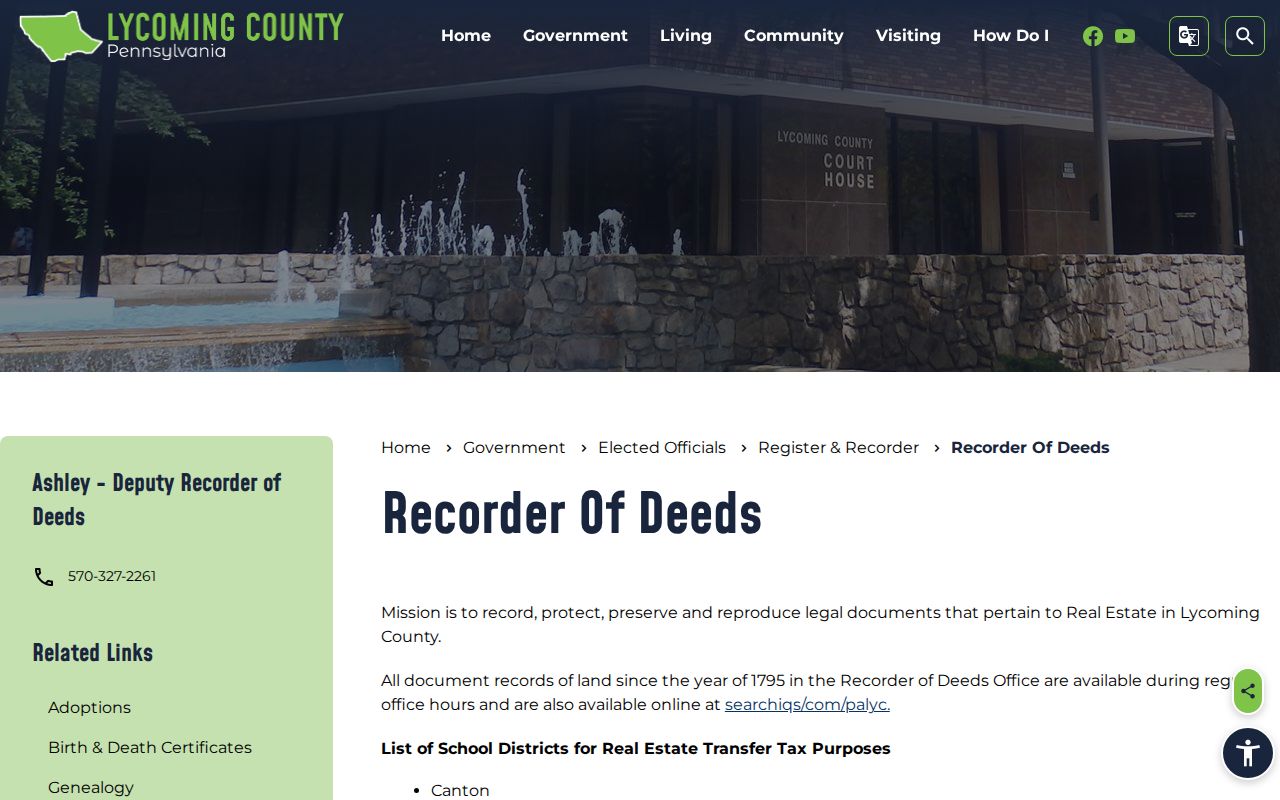
For an unclear instrument, call the Register and Recorder office or use the courthouse counter with the party name, approximate date, instrument or book and page, or property description. Name-based document alerts can warn a property owner about a recorded filing, but they are not title proof and do not replace an index search.
Note: A recorded party provides a dated land-document connection, while a present household requires separate evidence and may not be a public record at all.
Williamsport Civic Bodies Near a Block
Williamsport’s official boards page provides civic context, not a directory of private neighborhood groups. It lists public bodies and meeting information, including the Historic Architectural Review Board, Committee of Historic Preservation, and Planning Commission. These bodies can help a researcher understand a public preservation, planning, or civic process affecting a block. They do not provide a verified resident roster, member directory, or an official citywide association list.
| City public body | Useful block-level context |
|---|---|
| Historic Architectural Review Board | Public preservation review and meeting context where a block falls within its relevant work. |
| Committee of Historic Preservation | Historic-preservation discussion and records available through the City’s public boards materials. |
| Planning Commission | Public planning and meeting context tied to city planning matters. |
Research found no official Williamsport neighborhood-association or HOA umbrella directory and no official member roster. That absence is meaningful. Do not fill the gap by treating public board contacts as private neighborhood contacts, and do not infer a group or its members from a property map.
Williamsport Neighbors Voter Limits
Pennsylvania Election Code section 1404 allows computer inquiries about an individual elector and sets rules for a public information list. Before obtaining or inspecting names or information from that list, a person must show identification and make a written statement that the information will not be used for unrelated purposes. The list may include name, address, date of birth, voting history, and voting districts, but it cannot include an electronic signature or SURE registration number. Protected voters have additional safeguards.
The Pennsylvania public-information-list statute sets the boundary for this county process.
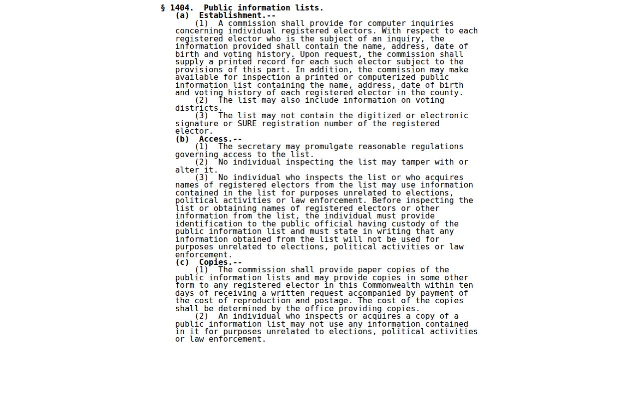
Williamsport neighbors cannot be established from an address-sorted voter file. Contact Lycoming Voter Services for the current lawful individual inquiry or list procedure, then follow its identification and written-use requirements. Voting history reflects participation, never a ballot choice, and a registered address does not prove every household member.
Williamsport Neighbors Through Time
For a historic block, James V. Brown Library and Taber holdings can be more informative than a modern land index. City directories, newspapers, maps, and photographs can place a block in a particular period. James V. Brown Library lists Williamsport city directories from 1866 through 1931. Check the exact volume and page, then note whether the entry concerns an individual, owner, or business. The collection summary does not establish that every volume has a reverse or criss-cross address section, so ask library or Taber staff before assuming an address index exists.
Current parcel systems and historic sources answer different questions. The current chain identifies the map parcel and recorded land history. A directory or newspaper can show a dated name or block event. Neither source automatically carries forward to another year. For later periods after the 1931 directory run, use newspapers, County records, and current property systems, keeping the date beside every claim.
Williamsport Neighbor Privacy Limits
Privacy rules remain in force around a block. Pennsylvania’s Address Confidentiality Program gives qualifying participants a substitute mailing address for specified government and court records, voter registration, DMV, schools, utilities, and marriage records. It is a prospective safety program, not a retroactive eraser of a historic deed, directory, or court entry. Ask the program and the original custodian about a specific record. State voter alternate-address rules and protected-voter handling add further limits.
Right-to-Know requests do not bypass court seals, vital-record restrictions, adoption confidentiality, protected election information, or PennDOT limits on driver and vehicle records. The public status of a map label or an index entry does not make it proper to recreate private household information. If a court or Recorder record needs correction or redaction guidance, contact the originating office with the case or instrument detail.
Williamsport Neighbors Official Checks
A commercial neighbor product may combine public, licensed, and user-supplied material. It can be stale, wrong, or unable to show which record supports a claim. An official source is narrower, but it identifies the custodian and the document boundary. For a Williamsport block, that distinction matters more than speed. Compare the map, parcel identifier, legal description, and dated instrument before relying on a result.
| Official record route | Commercial neighbor category |
|---|---|
| Names the county or city custodian, parcel, date, and record type | May combine records from different dates and sources |
| Has defined access limits, counter procedures, and correction contacts | May not show the original source or its access boundary |
| Supports a parcel-specific fact when the record matches | Can provide a lead, but needs confirmation with the original custodian |
Use the map-to-record chain for the adjacent parcel question, not as a list-building shortcut. A dated recorder document, a City Codes file where releasable, or a historic library source can add context without claiming more than the record actually says.