
Williamsport ZIP Code Coverage
Lycoming County’s planning material identifies 17701 and 17702 as the ZIP codes in a City of Williamsport study area. They are the primary local starting points, but neither turns into a city-boundary line. The postal Williamsport label extends beyond the incorporated city, and 17702 is also associated with South Williamsport and nearby areas. The other Williamsport-labelled codes below require USPS confirmation before any address or coverage conclusion is made.
| ZIP Code | Areas Covered | Post Office | Notes |
|---|---|---|---|
| 17701 | Primary Williamsport study area and surrounding county areas | Williamsport PA S&DC, 2901 Reach Road, 17701-9922 | Also reaches beyond city limits. Check the parcel municipality. |
| 17702 | Williamsport study area; associated with South Williamsport and nearby areas | Confirm the actual address with USPS; South Williamsport Post Office is listed at 1223 W. Southern Ave. | City of Williamsport and South Williamsport borough are distinct municipalities. |
| 17703 | Williamsport-labelled post-office-box code reported in postal reference data | Confirm through USPS Cities by ZIP Code | No street area or resident coverage is assumed. |
| 17705 | Williamsport-labelled unique code reported in postal reference data | Confirm through USPS Cities by ZIP Code | Treat as a special postal code, not a residential-area claim. |
The table is deliberately cautious for 17703 and 17705. The research could not capture a complete current response from the interactive USPS service, so no neighborhood boundary, delivery route, or population is assigned to either code. Enter a real address or run Cities by ZIP Code in USPS before relying on a label.
Williamsport Postal Labels and Limits
The Lycoming County planning appendix provides the local basis for treating 17701 and 17702 as the central study-area codes. It does not make those ZIP codes municipal boundaries. A postal label may cover a location in the city, a borough, or a township. Use a parcel’s municipality field, UPI, and legal description when a governmental jurisdiction matters.

This planning source supports the local ZIP starting point without overstating it. Across the river, 17702 can be associated with South Williamsport and nearby area, while 17701 reaches surrounding county areas. A ZIP result therefore needs a county map or assessment check before it is used to infer the municipality of a property.
The distinction is not just current postal geography. The county’s description of the 1950 Williamsport Sanborn material includes parts of Armstrong Township, Duboistown, Old Lycoming Township, and South Williamsport. A Williamsport-labelled historic record may therefore require a map and municipal check before it is treated as a city record.
Verify a Williamsport ZIP Code
Use the official USPS ZIP Lookup for the actual mailing address. Its three relevant choices are ZIP Code by Address, ZIP Code by City and State, and Cities by ZIP Code. USPS may standardize the address format differently from the text entered. Most importantly, USPS says that a ZIP result does not confirm that a person or organization is at an address. It verifies routing information, not a person’s connection to the location.
The USPS location listing for Williamsport PA S&DC is the source for the postal-location reference shown below.
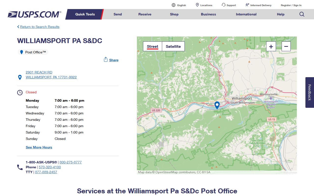
The listing identifies the facility at 2901 Reach Road with ZIP+4 17701-9922. That listing is a postal-location reference, not a public office for finding people. For an individual street address, the address lookup tool is the proper verification step.
Williamsport USPS ZIP Code Inputs
Choose the USPS route that matches the information already in hand. A city-and-state result is a broad starting point, while a full street-address result is the better test for one mailing location. Save the standardized result alongside the original input when an older directory, deed, or map uses a different style.
| USPS tool mode | Starting information | What to record | Local limit |
|---|---|---|---|
| ZIP Code by Address | Actual street address | USPS-standardized address, ZIP, and ZIP+4 if returned | Does not prove who is connected to the address. |
| ZIP Code by City and State | Williamsport, Pennsylvania | Candidate ZIP codes for the postal city label | Not a city-boundary or parcel search. |
| Cities by ZIP Code | One ZIP code | Current postal-city association | Confirm special codes before assigning any coverage. |
ZIP+4 adds a more specific delivery segment to the five-digit ZIP. It is still postal routing information, not a parcel identifier. Do not replace the county UPI with a ZIP or ZIP+4 when matching a deed or assessment record.
Williamsport ZIP-to-Parcel Workflow
A ZIP search becomes more reliable when it ends with the property record rather than a postal label. The following order keeps the different geography systems separate.
- Enter the actual mailing address in USPS ZIP Lookup and retain its standardized form, ZIP, and ZIP+4 when returned.
- Locate the same address in Lycoming County’s map and assessment pathway. Record the UPI, municipality, situs location, and legal description as shown.
- Use the parcel key and legal description for assessment and recorded-land research. A postal city may not match the municipality shown on the parcel.
- For an older address, compare the appropriate historical directory year, map, and deed description. The postal label and municipal context may have differed in the relevant era.
- Use the county election office, not a ZIP code, for precinct or voter questions. Postal geography does not determine election districts.
Once the parcel is fixed, a street-level address trail can be followed through Williamsport streets. That more detailed route still requires the same caution about recorded owners, historic listings, and current residence.
Williamsport Property Searches by ZIP
Lyco Online does not document a ZIP filter on its landing page. Its visible routes are Parcel Search by UPI, Map Search, and subscription-gated Owner, Address, and Advanced Search. The county says broad criteria-based access has a stated $700 annual comprehensive subscription. A ZIP code is therefore useful to verify the mailing location before property research, but it is not a documented county search field for a ZIP-wide parcel result.
This is an important comparison: USPS can validate the mail-routing result for a known address, while Lyco’s public map and UPI routes connect that address to land records. Neither source is designed to return a ZIP-wide resident roster. Use a known street address and its UPI, then follow the record type that actually holds the requested fact.
Assessment systems can hold both a situs location and an owner mailing address. The latter may be a post-office box, an agent, an estate, a trust, a business, or another location, so it is not evidence that the owner is physically at the parcel. The county portal’s exact parcel-card fields were not publicly observable without a valid UPI or authorized access. Record only the fields visible in the actual county record and verify ownership against the most recent deed.
Use Map Search to move from an address toward a parcel and UPI. Then use the public UPI route or contact the Assessment Office for the official record. The county ArcGIS gallery is an address-to-parcel bridge, not a title record and not a way to identify everyone at a location. Follow a recorded deed only after the UPI, municipality, and legal description point to the same property.
Historical Williamsport ZIP Labels
ZIP codes cannot be projected backward onto every historical address. James V. Brown Library’s online City Directories run from 1866 through 1931, and their entries need to be read by specific year. A historical Williamsport label may also need municipal context. The Library of Congress description of Williamsport Sanborn material includes parts of Armstrong Township, Duboistown, Old Lycoming Township, and South Williamsport, showing why a broader place label requires a map check.
Use a directory year, street number, and map sheet to establish what was printed at that time. Then connect the location through parcel and deed description where possible. No verified citywide street-renumbering authority was located in the research, so legal description, subdivision or lot information, and mapped landmarks are safer bridges than an assumed numeric continuity. The directory collection does not verify a reverse or criss-cross year run, so ask library staff about a particular volume rather than assuming an address index exists.
Williamsport City and ZIP Comparison
The Census QuickFacts profile for Williamsport city uses the incorporated city as its geographic subject. That makes it a useful contrast to postal routing geography. A city statistic does not describe a ZIP, and a ZIP statistic would not identify the city boundary. Keep the source geography in the citation every time these two systems appear together.
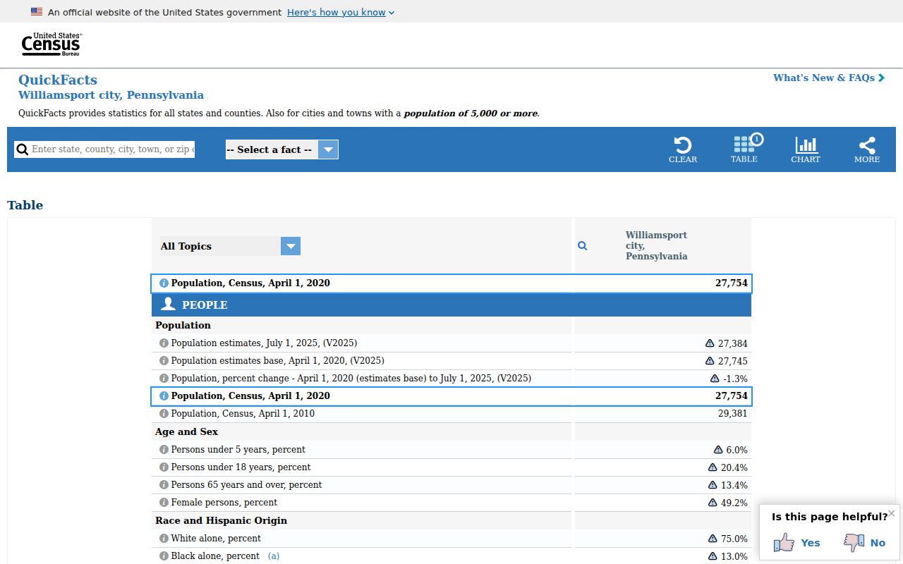
This city-versus-postal comparison is especially important near 17701 and 17702. For a government record, start with the municipality and parcel. For a mailing address, start with USPS. For a historical property trail, use the legal description and time-specific map as the common reference point.
Williamsport ZIP Code Definitions
These terms describe postal routing and property identification. They should not be used as shortcuts for residence or city jurisdiction.
- ZIP code
- A five-digit USPS routing code for mail delivery. It is not a political boundary, assessment parcel, or voting district.
- ZIP+4
- The five-digit ZIP plus four more digits for a smaller delivery segment. It improves mail routing but does not identify a legal parcel.
- PO-box ZIP
- A code associated with post-office boxes. The Williamsport-labelled 17703 code requires current USPS confirmation before any coverage statement.
- Unique ZIP
- A special postal code used for a particular postal purpose or organization. The Williamsport-labelled 17705 code must be verified with USPS, not assumed to cover a residential area.
- Carrier route
- A USPS delivery grouping below the ZIP level. It is a mail-routing term and not proof of a city boundary or a person’s connection to an address.
- Situs and legal description
- Situs is the physical property location. A legal description is the recorded land description used with the UPI to match the correct parcel.